
FMB is a Field Measurement Book Map or Sketch. It is a compilation of sketch data stored in volumes by the Tahasildar office of the Tamil Nadu government. This article provides information on Tamil Nadu FMB Map download, Tamil Nadu Patta Chitta FMB Map, getting and viewing FMB map online, etc.
In this FMB, every survey number map is preserve at a scale of 1:1000 or 1:2000. Every survey number is divide into different sub-divisions and will have its property owner.
It denotes accurate dimensions of the land. So in every property purchase transaction, the map is used to verify the land measurements and boundaries.
What are the Components of FMB?
Below are the different components of the FMB Map.
- G-Line: These are outlines making of the entire FMB sketch. It is an imaginary line that converts the map into various sizes.
- These sizes are triangles that fix the boundary lines and different points in the map. Sometimes errors occur and cause all the proper calculations.
- F-Line: These signify the actual field boundaries in the outer lines of the map. F-line points are fix regarding their offset distance from G-line.
- Subdivision Lines: These lines will specify a small portion of land within the survey number—the subdivision lines defined by ladder except for the graphical representation in FMB Sketch.
- Ladder: It is a field line point defined concerning the offset distance for G-line and sometimes deviates to the left or right side.
- The ladder highlights the deviation of left or right. FMB sketch was produce as the outline by converting the ladder into electronic data.
- Extension Lines: Every survey number field forms an important part of the village FMB map. As a result, the other fields surround each sketch. The exact direction where the subject field joins the neighbouring field is depicted as an extension line of FMB.
- Neighbouring field survey numbers: These are the other surrounding field numbers marked around each FMB sketch and facilitate the conversion of FMB maps into D-sketches.
How to View FMB Map Online?
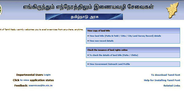
- First, Tamil Nadu’s citizens must visit the Anytime/Anywhere e-Services official website to view FMB Map online.
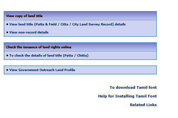
- Click on the view Patta Chitta FMB Map TSLR Extract on the home page.
- A new page opens.
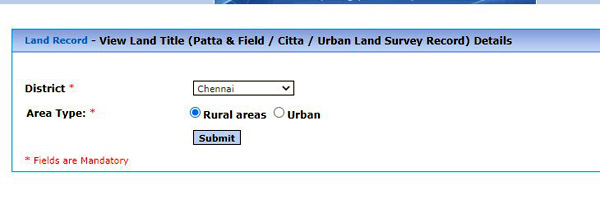
- Now select the district area as Rural/Urban and click on submit option.
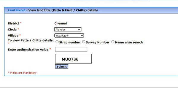
- Again a page opens; now select the Taluk, Village, and View Patta Chitta FMB Map using the Patta number/Survey number.
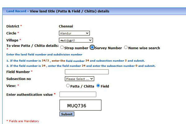
- If the Patta number is select, the applicants must enter the Patta number, enter the authentication value and click on submit option.
- If the survey number is select, the applicants must enter the survey number and sub-division number, view Patta Chitta or Map, enter the authentication value and click on submit option.
- Now the Patta Chitta Map will display on the screen. The applicants can download it and take a printout also.
- Citizens can view the map online by following the above process.
How to get FMB Online?
- There is no online procedure in Tamil Nadu currently to get FMB Sketch.
- The applicants can also get the Tamil Nadu FMB Map or sketch at the Tahasildar office.
- The concerned Tahasildar maintains the FMB sketch, and upon request, the authorized Tahasildar officer will survey the property.
- The request must be in written form and given to the Tahasildar.


good
citta patta fmb
I received the fmb without ladder.how to get the fmb with ladder in online
WHAT ABOUT CHENNAI FMB .WE CANNOT DOWNLOAD FMB.HOW TO DOWENLOAD
I can’t recevie the fmb of my records.
it displays the [Digitized Maps are not available for the given input]
so please take the action for this problem
FMB is available online and can be downloaded too.
patta no 1105 fmb provid
I received the fmb without ladder.how to get the fmb with ladder in online